 Lýsigagnagátt
Geographical names
Type of resources
Available actions
Topics
INSPIRE themes
Keywords
Contact for the resource
Provided by
Years
Formats
Representation types
Update frequencies
Service types
Scale
-

ELF Geographical Names (GN) Iceland is one of 12 themes in the European Location Project (ELF). The purpose of ELF is to create harmonised cross-border, cross-theme and cross-resolution pan-European reference data from national contributions. The goal is to provide INSPIRE-compliant data for Europe. A description of the ELF (European Location Project) is here: http://www.elfproject.eu/content/overview Encoding: INSPIRE version 4
-
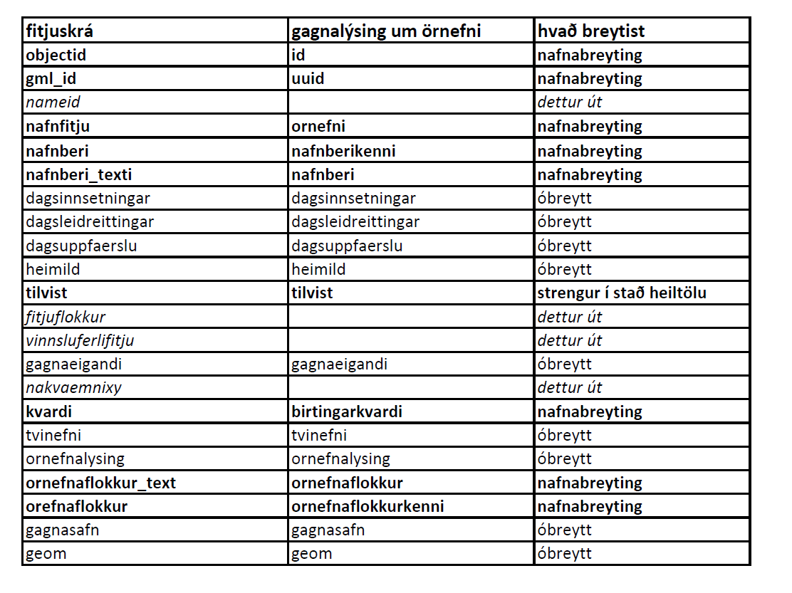
Örnefni eru í þremur lögum: flákalag, punktalag og línulag. Uppfærð örnefni birtast vikulega í vefsjám.
-
Niðurhalsþjónustur í samræmi við INSPIRE tilskipunina og grunngerð landupplýsinga
-

EuroRegionalMap is a Pan-European multi-functional topographic vector dataset at scale 1: 250000, that is seamless and harmonized across boundaries. It is produced in cooperation with the National Mapping Agencies of the participating countries using official national databases. The dataset covers 36 countries and is designed for business use. It enables you to process comprehensive spatial analysis. Transport and water networks have full connectivity and administrative boundaries are topologically consistent. The National Database (IS 50V at 1:50 000 was used to update the datasets. There are some natural deviations from ERM topology rules and feature selection criteria for Icelandic ERM data.
-

Skoðunarþjónustur í samræmi við INSPIRE tilskipunina og lög um grunngerð fyrir stafrænar landupplýsingar